
Driving the 1,200 miles of our route up the West Coast, we were struck with the diversity of the landscape of America’s Pacific states (California in particular). We left a desert valley and drove up through a mountain pass into the sprawl of Los Angeles. From there we meandered north through the San Emigdio Mountains, scrubby green and brown compared to the bare, craggy mountains we left in Palm Springs.
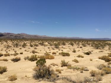
The Deserts of Southern California
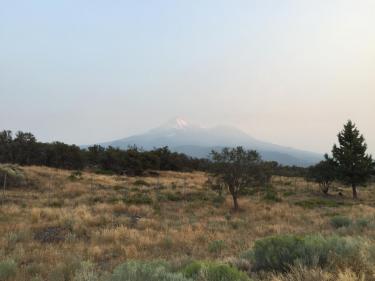
Haze Obscured Mount Shasta, California
After a long, dramatic descent from the mountains, we were in the flat agricultural lands of central California. The views, like the rows of fruit trees and vegetable crops, seemed to go on forever. North of wine country, the terrain got more and more varied, becoming thick wilderness of massive pine and fir trees amidst mountains this sea-level travel blog couple can’t help but marvel at. As the forests stretched into Washington, they get wetter, becoming rain forests edging the fingers of water from the Puget Sound, nestling the mountains to the east, the constant drain of water slowly cutting gorges and valleys, trickles growing to rivers and creating spectacular waterfalls.
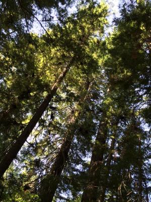
Majestic Firs and Ponderosa Pines, Washington
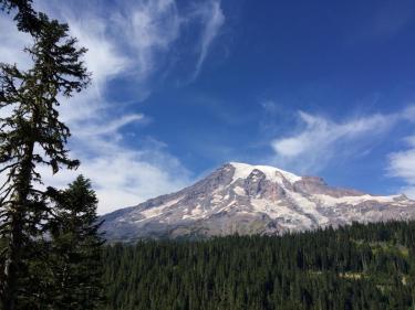
Mount Rainier, Washington
The scenery made this one of the easiest, most pleasant, thousand-plus mile drives we’ve ever done. If you like road trips, put an end-to-end trip on Interstate 5 on your to-do list.
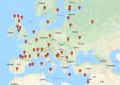
While we spent most of the summer in earthquake land, the farther north we drove the more we got into volcano land. Our first encounter was with Mount Shasta in California (“possibly active” according to the US Geological Survey). But then there was Mount Rainier (worthy of its own blog), Mount St. Helens, Mount Hood, and Three Sisters. These were just the volcanoes that we’ve seen; there are also Mount Baker, Glacier Peak, Mount Adams, Mount Jefferson, Newberry, and (as we blogged about yesterday) Mount Mazama sleeping beneath Crater Lake.
Not only is this corner of the country shaky, it’s fiery. And just plain beautiful.
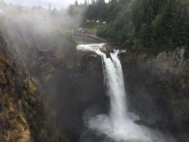
Snoqualmie Falls, Washington
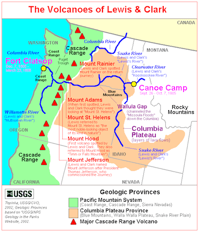
Volcanoes of the Pacific Northwest, Courtesy of the United States Geological Survey