You have to wonder if technology will eventually take all the fun out of travel planning, especially when you come across a site like Rome2Rio.com. This is simply an amazing website, destined to be our go-to-resource for travel planning.
In the old days (as in last month), if I were trying to figure out how to get from point A to point B, the process went something like this: identify the airports nearest points A and B, find flights between points A and B, then determine if it’s possible to take public transit (train, bus, ferry, hang glider, etc.) to point A’s airport and from point B’s airport. If the latter isn’t possible, then plan to walk or rent a car. Rome2Rio turns that process on its ear.
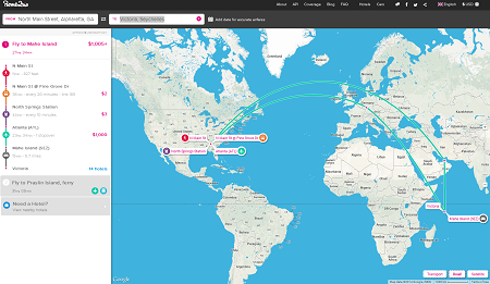
Let’s say Lori and I wanted to go to the Seychelles (we do, actually). Having done all our lodging research we realize we need to get to the town of Victoria, Seychelles where our beachside hotel is located. In the Rome2Rio search box on the main page, we enter our Point A, not as the Atlanta airport, but our true starting point, as in our hometown of Alpharetta, or even as precise as our house address. Then we enter our Point B with similar precision. Then we click Search and magic happens.
 |
| The Rome2Rio Search Results Page |
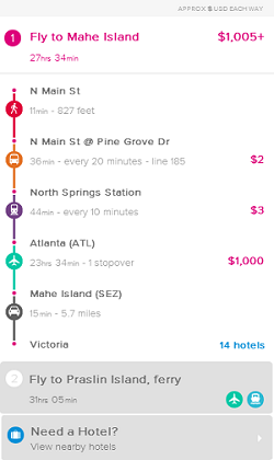
For the cartophiles out there, you are presented with a map that shows your transit options, including all legs and means of travel for the options Rome2Rio can devise for you. To the left of the map you get detailed information about those options. In my example, Rome2Rio offers two transit options, marked clearly with circled numbers 1 and 2.


